Kilimanjaro hike Umbwe Route
Kilimanjaro hike Umbwe Route
Overview
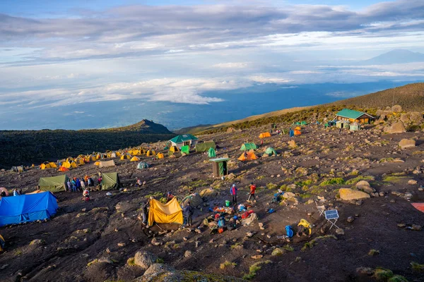
Kilimanjaro hike Umbwe Route has a reputation for being the most challenging route on Kilimanjaro taking you 6 days. And rightly so. It’s the shortest and steepest of the Kilimanjaro routes, and accordingly has a poor acclimatization profile. For this reason, its summit success rate is low and it’s one of the least used trails on the mountain. The Umbwe approaches the summit from the south and camping is the only available accommodation option. Pre-acclimatization is recommended for those who choose to trek this route.
Day 1: Arusha/Moshi to Umbwe gate
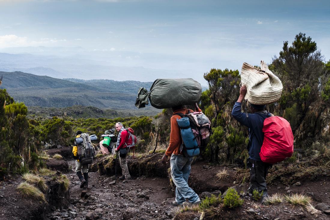
Your day starts early with a briefing, followed by breakfast and an hour drive from Moshi/Arusha to Umbwe Village (1,490 m/4,890 ft) where your guides and porters pack your equipment and supplies, and give you a lunch pack. You start your ascent at the small Umbwe Gate just above the village and follow a gentle winding vehicle track for an hour to a signboard that announces the small steep Umbwe trail.
The introduction is over, and you now climb up for several hours through a dense forest of rubber trees and giant fig trees. In places, you must scamper up steep sections of roots and rock. The Umbwe Camp is in the forest, and there are some caves nearby. You will be greeted here with a graciously served hot meal.
Elevation(m): 915m/1387m to 1,800 m 2,800 m
Elevation(ft): 3,000 ft/4921ft to 5,905 ft to 9,190 ft
Distance: 8 km
Hiking Time: 5-7 hours
Habitat: Montane Forest
Main Destination: Foothills of Mt Kilimanjaro (Area)
Accommodation: Budget camping (In or near Foothills of Mt Kilimanjaro)
Meal plan: All meals and Drinking water (excludes extra drinks)
Day 2: Umbwe Camp to Barranco Camp
Your day starts early with a steaming cup of tea coffee and there after you will climb steeply through thinning forest glades to Giant Erica, Heather, and drier air. You continue up a ridge that drops steeply on both sides, and hopefully, the clouds will part to reward you with a view of Uhuru Peak looming overhead. After lunch, you enter a zone of giant groundsels (Senecio Kilimanjaro) that seem to guard the heights, and this garden is one of Kilimanjaro’s special treasures.
Elevation(m): 2,800 m to 3,900 m
Elevation(ft): 9,190 ft to 2,800 ft
Distance: 8 km,
Hiking Time: 4-5 hours
Habitat : Semi-Desert
Main Destination: Mount Kilimanjaro (Mountain)
Accommodation: Budget camping (In or near Mt Kilimanjaro)
Meal plan: All meals and Drinking water (excludes extra drinks)
Kilimanjaro hike Umbwe Route
Day 3: Barranco Camp to Karanga Camp
After breakfast, we continue up a steep ridge to the great Barranco Wall, then you climb this imposing obstacle, which turns out to be easier than it looks. Topping out just below the Heim Glacier, you can now appreciate just how beautiful Kilimanjaro really is. With Kibo’s glaciers soaring overhead, you descend into the lush Karanga Valley to the Karanga Valley campsite.
From the camp, you can look east and see the jagged peaks of Mawenzi jutting into the African sky. After a hot lunch in camp, your afternoon is at leisure for resting or exploring. This short day is very important for your acclimatization, since your summit push is about to start.
Elevation(m): 3,900 m to 4,200 m
Elevation (ft):12,800 ft to 13,780 ft
Distance: 7 km,
Hiking time: 4 hours
Habitat: Alpine Desert
Main Destination: Mount Kilimanjaro (Mountain)
Accommodation: Budget camping (In or near Mt Kilimanjaro)
Meal plan: All meals and Drinking water (excludes extra drinks)
Kilimanjaro hike Umbwe Route
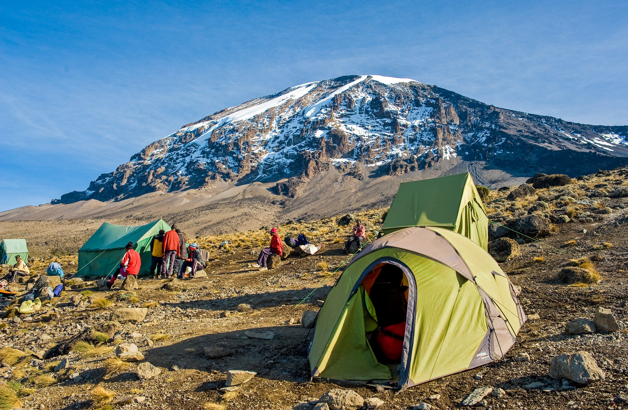
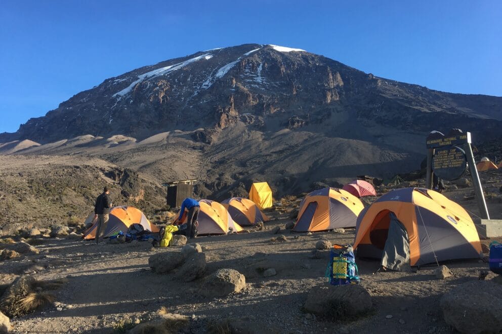
Day 4: Karanga Camp to Barafu Camp
In the morning, you hike east over intervening ridges and valleys to join the Mweka Route, which will be your descent route. Turn left toward the mountain and hike up the ridge through asperse landscape for another hour to the Barafu Hut where you will receive a hot lunch. The last water on the route is in the Karanga Valley; there is no water at Barafu Camp, even though Barafu is the Swahili word for “ice.”
Kilimanjaro hike Umbwe Route
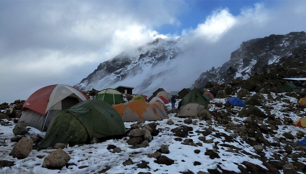
The famous snows of Kilimanjaro are far above Barafu Camp near the summit of the mountain. Your tent will be pitched on a narrow, stony, wind-swept ridge, so make sure that you familiarize yourself with the terrain before dark to avoid any accidents. Prepare your equipment and warm clothing for your summit climb, and also drink a lot of fluids. Finally you’ll have an early dinner, go to bed for a few hours of precious sleep.
Elevation(m): 4,200 m to 4,550 m
Elevation(ft): 13,780 ft to 14,930 ft
Distance: 13 km,
Hiking Time: 8 hours
Main Destination: Mount Kilimanjaro (Mountain)
Accommodation: Budget camping (In or near Mt Kilimanjaro)
Meal plan: All meals and Drinking water (excludes extra drinks)
Day 5: Barafu Camp to Uhuru Peak to Mweka Camp
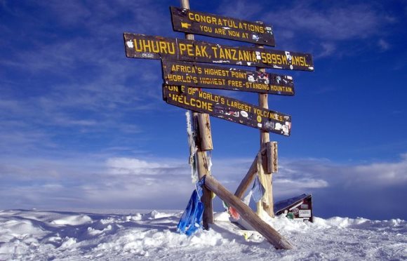
You will rise around 11:30 PM, and after some steaming tea and biscuits, you shuffle off into the night. Your 6-hour climb northwest up through heavy scree between the Rebmann and Ratzel glaciers to Stella Point on the crater rim is the most challenging part of the route for most climbers. At Stella Point (5,685 m/18,650 ft) you stop for a short rest and a chance to see a supremely sanguine sunrise.
At Stella Point you join the top part of the Marangu Route, but do not stop here too long, as it will be extremely difficult to start again due to cold and fatigue. You may encounter snow on your remaining hike along the rim to Uhuru Peak. On the summit, you can enjoy your accomplishment and know that you are creating a day that you will remember for the rest of your life. There after your 3-hour, you will then descend from the summit back to Barafu Camp.
Elevation(m): 4,550 m to 5,895 m to 3,100 m
Distance: 7 km up, 23 km down
Hiking Time: 8 hours up, 7-8 hours down
Main Destination: Mount Kilimanjaro (Mountain)
Accommodation: Budget camping (In or near Mt Kilimanjaro)
Meal plan: All meals and Drinking water (excludes extra drinks)
Day 6: Mweka Camp to Mweka Gate to Moshi/Arusha
After a well-deserved breakfast, it is a short, scenic, 3-hour hike back to the park gate. Don’t give your porters any tips until you and all your gear have reached the gate safely, but do remember to tip your staff at the gate. At Mweka Gate, you can sign your name and add details in a register. This is also where successful climbers receive their summit certificates.
Climbers who reached Stella Point are issued green certificates and those who reached Uhuru Peak receive gold certificates. Finally from the Mweka Gate, you will continue down to the Mweka Village, possibly a muddy, 3 km, 1 hour hike if the road is too muddy for vehicles.
Arusha/Moshi
Elevation(m): 3,100 m to 1,980m to890m/1387m
Elevation(ft): 10,170 ft to 6,500m to 2,920 ft/4921ft
Distance: 15 km
Hiking Time: 3 hours
Habitat: Forest
Main Destination: Mt Kilimanjaro Summit (Mountain)
Accommodation: No accommodation (End of tour)
Meal plan: All meals and Drinking water (excludes extra drinks)
End of your 6-Day Kilimanjaro hike
Inclusives and Exclusives
Includes
- Porterage
- Rescue fee
- Park fees (For non-residents)
- All activities (Unless labeled as optional)
- All accommodation (Unless listed as upgrade)
- Camping equipment
- A professional driver/guide
- All transportation (Unless labeled as optional)
- All Taxes/VAT
- Airport transfer
- Meals (As specified in the day-by-day section)
- Drinking water (On all days)
- Sleeping bags
Excludes
- Climbing gear
- International flights (From/to home)
- Additional accommodation before and at the end of the tour
- Tips (Tipping guideline US$20.00 pp per day)
- Personal items (Souvenirs, travel insurance, visa fees, etc.)
- Government imposed increase of taxes and/or park fees