Mount Longonot National Park
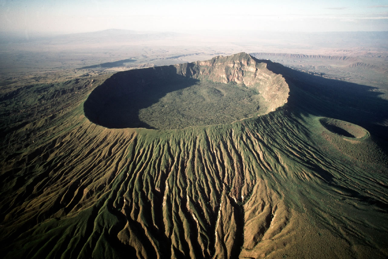
Mount Longonot National Park is a stratovolcano located southeast of Lake Naivasha in the Great Rift Valley of Kenya, Africa. It is thought to have last through eruption in the 1860s. Its name is from the Maasai word Oloonong’ot, meaning “mountains of many spurs” or “steep ridges”.
Kenya Wildlife Service protect Mount Longonot as part of Mount Longonot National Park. A 3.1 km trail runs from the park entrance up to the crater rim, and continues in a 7.2 km loop encircling the crater. The whole tour (gate-around the rim-gate) of 13.5 km takes about 4–5 hours allowing for necessary rest breaks – parts of the trail are heavily eroded and very steep. The gate elevation is around 2150 m and the peak at 2776 m but following the jagged rim involves substantially more than the 630 m vertical difference.
Mount Longonot is 60 kilometres northwest of Nairobi and you can access it by a tarmac road. A nearby town is also Longonot. The Longonot satellite earth station is in south of the mountain.
Park activities
Biking, Game viewing, Hiking, Rock Climbing, Viewing Lake Naivasha and also Walking
How to get there
The park is accessible via tarmac road from Nairobi (90 kms)
Attractions
Extinct volcano and crater forest, Scenic Landscape, Views of lake Naivasha and the Great Rift Valley
The park is a paradise for birds of prey